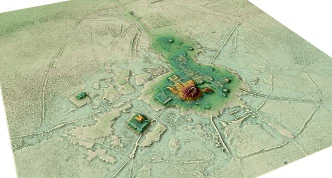
An airborne tool is revolutionizing archeology in wooded and hard-to-reach areas: the Lidar (Laser imaging detection and ranging), which scans the landscape to describe its topography while ignoring the vegetation cover. A study, published on May 26 in Nature, offers a new illustration of this by bringing to light pre-Hispanic urban centers in the Bolivian Amazon, linked by a network of raised causeways.
Some sites, like that of Cotoca (opposite), had already been identified, but the Lidar gives a much more detailed overview of the sometimes monumental structures – canals, esplanades and conical pyramids of about twenty meters high – made of earth dried, today masked by the savannah and the forest. For Heiko Prümers (German Institute of Archeology in Bonn) and his colleagues, the Casarabe culture, which developed in this territory between 500 and 1400 AD, had developed “a singular type of agrarian urbanism low-density tropical. Before disappearing for a still unknown reason…


